I use geospatial data, AI, and water resources modeling to understand how rivers and landscapes respond to extreme events, from the scale of a single channel to an entire continent, and what that means for the communities in their path. This is where I share my research, teaching, and work on rivers and floods.
Geospatial Data ScientistWater Resources EngineerFlood Risk AnalystEducator
Research
Filter by focus:
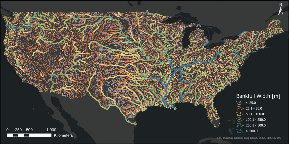
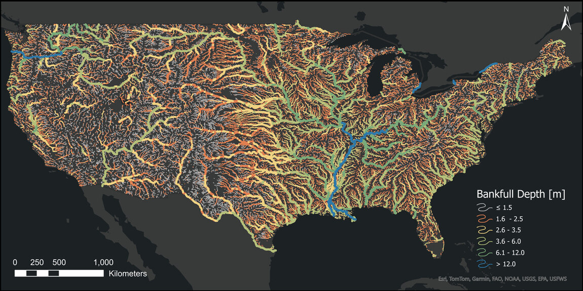
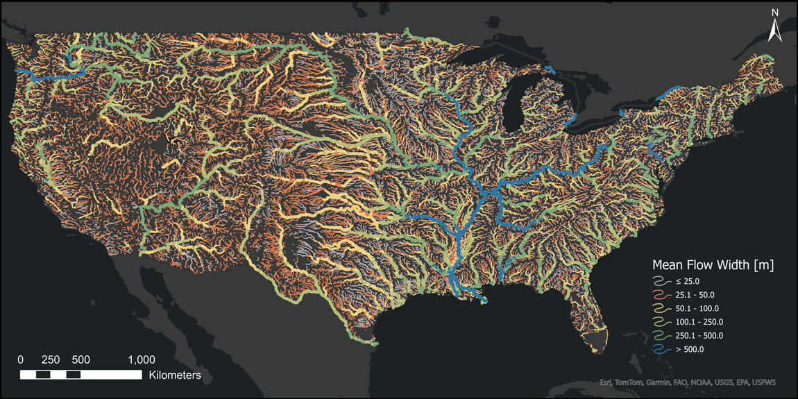
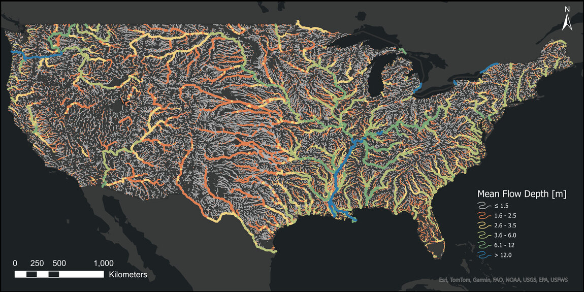
How wide and deep are rivers across the CONUS?
Machine learning estimates of river width and depth under mean-flow and bankfull conditions for 2.7 million river reaches across CONUS, using USGS field observations with geospatial datasets (STATSGO, NHDPlusV2, NLCD, NID, EVI, D50, and aridity index). The dataset improves bankfull width and depth estimates by 30% and 78%, respectively, over traditional models.
At least one rating curve for every river in the CONUS!
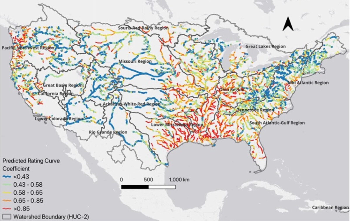
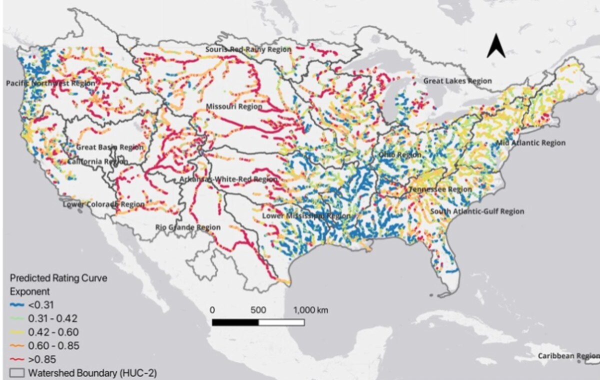
Machine learning estimation and construction of synthetic rating curve power-law parameters for 2.7 million river reaches across CONUS, using USGS observations together with channel geometry and hydrological and geospatial datasets.
How fast does a riverbed move under supercritical flow?
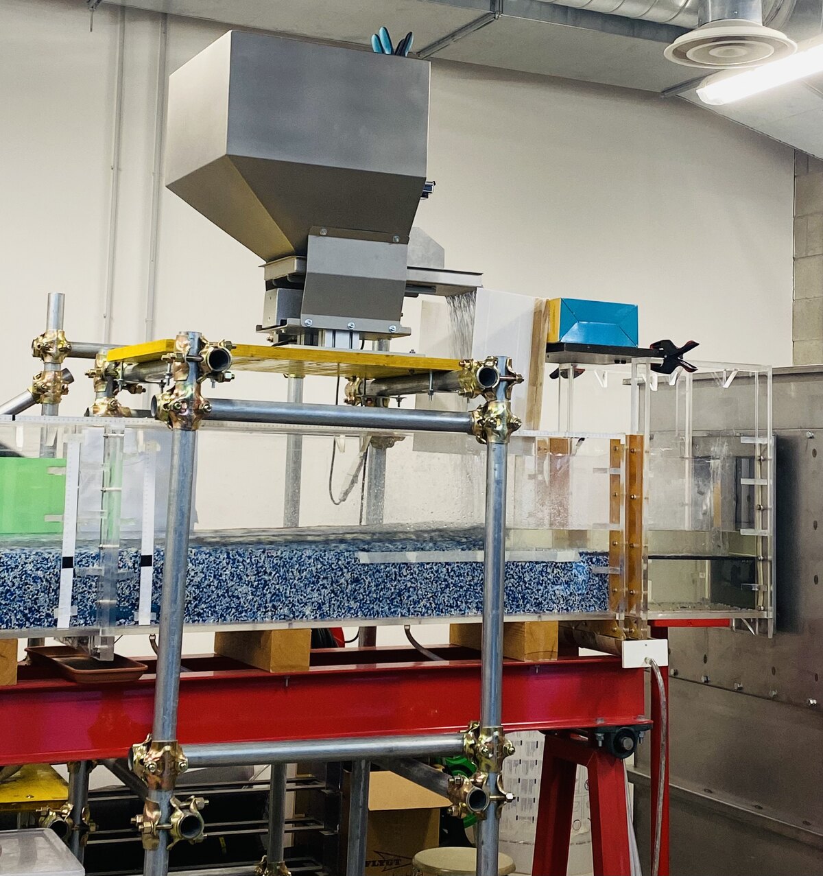
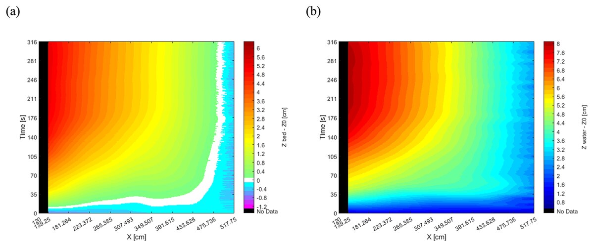
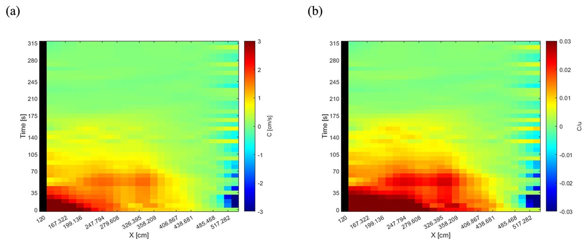
Laboratory investigation of sediment aggradation and its propagation through river channels under supercritical flow, showing that aggradation waves travel much more slowly than hydrodynamic perturbations, typically at less than 5% of the initial flow velocity.
Bringing missing river bathymetry into operational terrain-based flood mapping
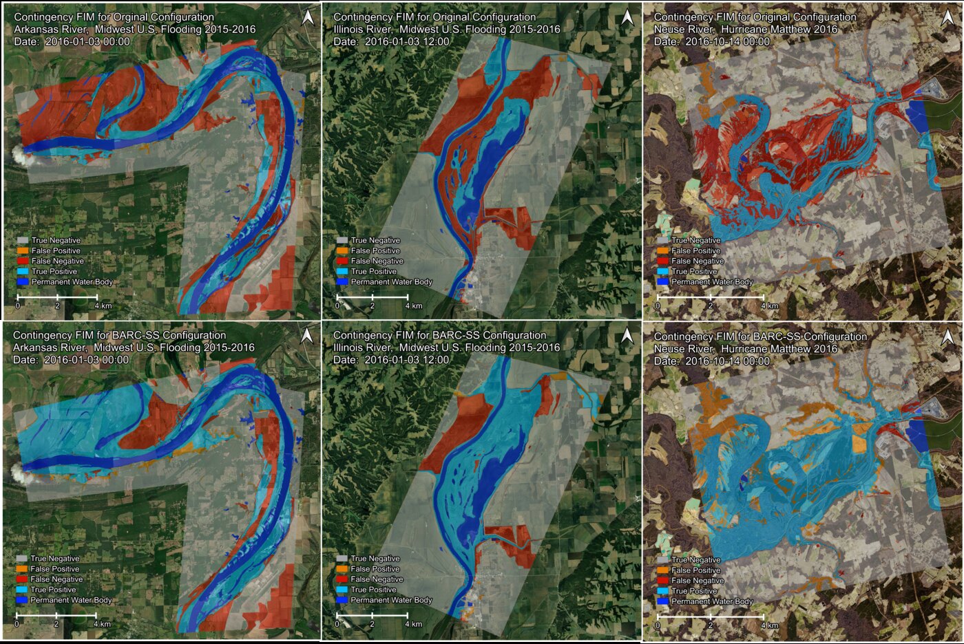
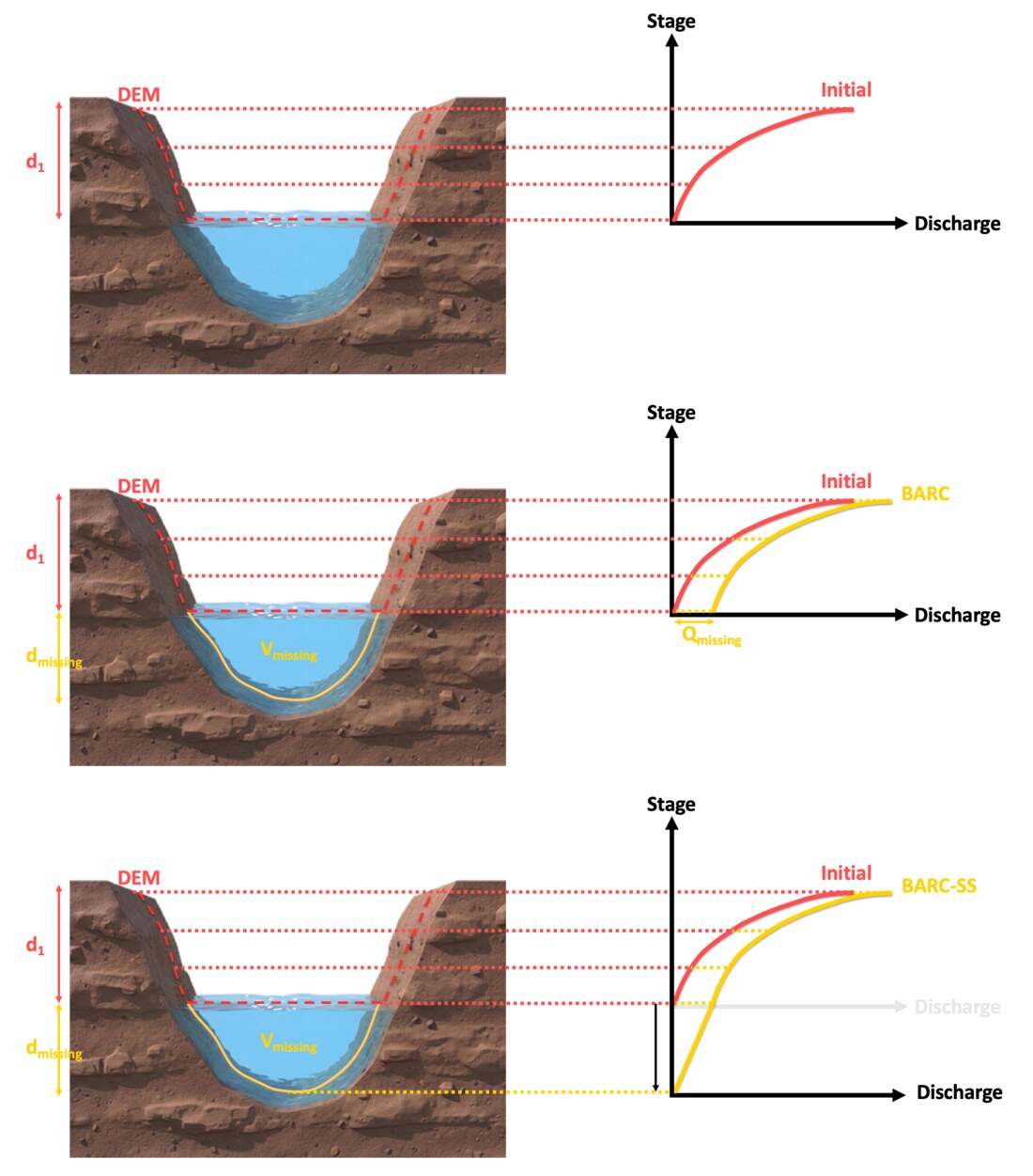
A scalable low-cost geospatial algorithm, BARC-SS, that accounts for river bathymetry missing from DEMs by adjusting synthetic rating curves within the operational OWP HAND-FIM framework. Tested across six major CONUS rivers, the approach improves flood-mapping accuracy by up to 110% and flooded-building detection by up to 120%.
Paper (coming soon)BARC-SS algorithm (coming soon)
Does river shape change the routed hydrograph?
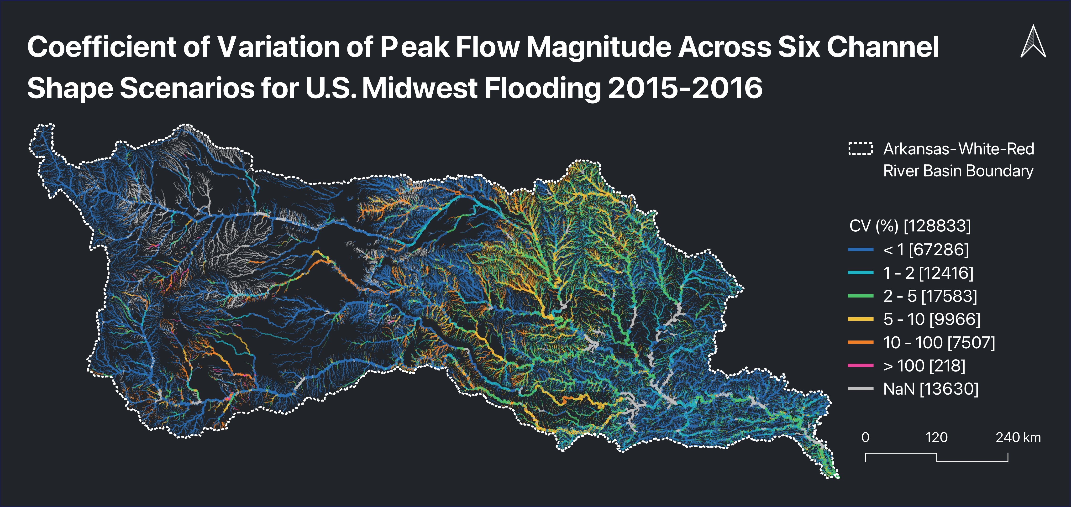
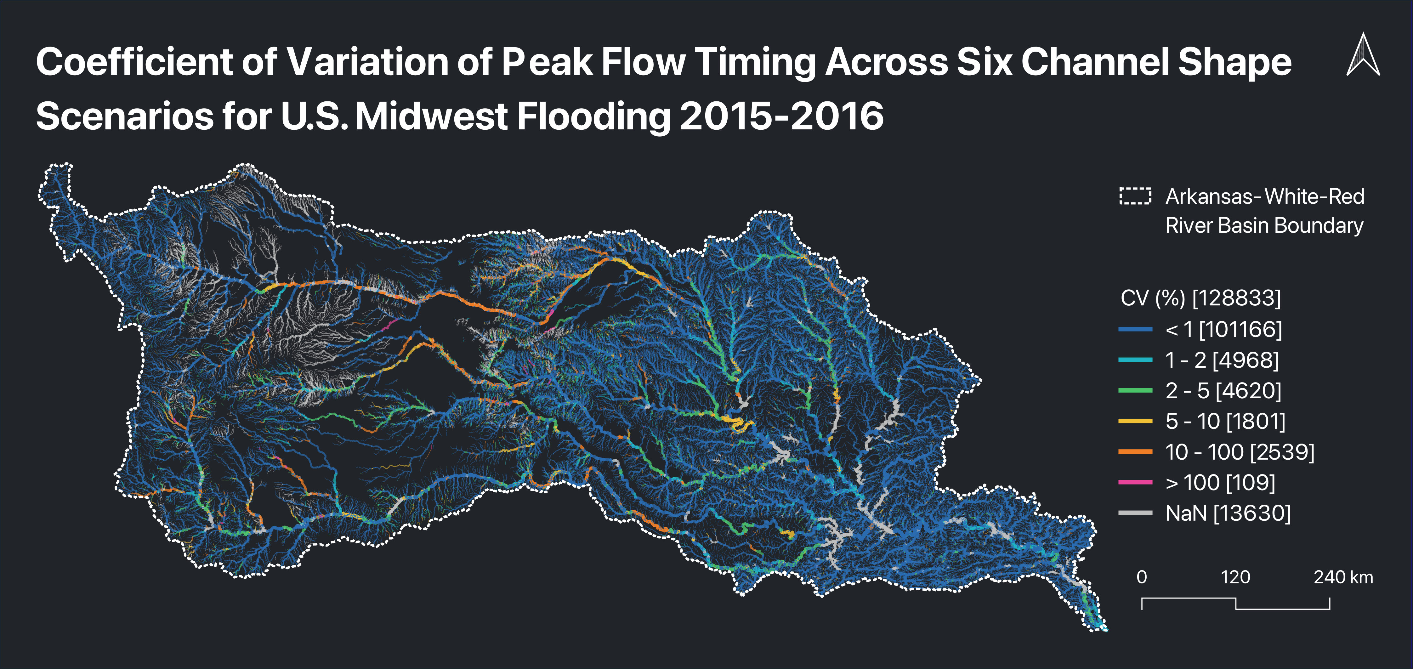
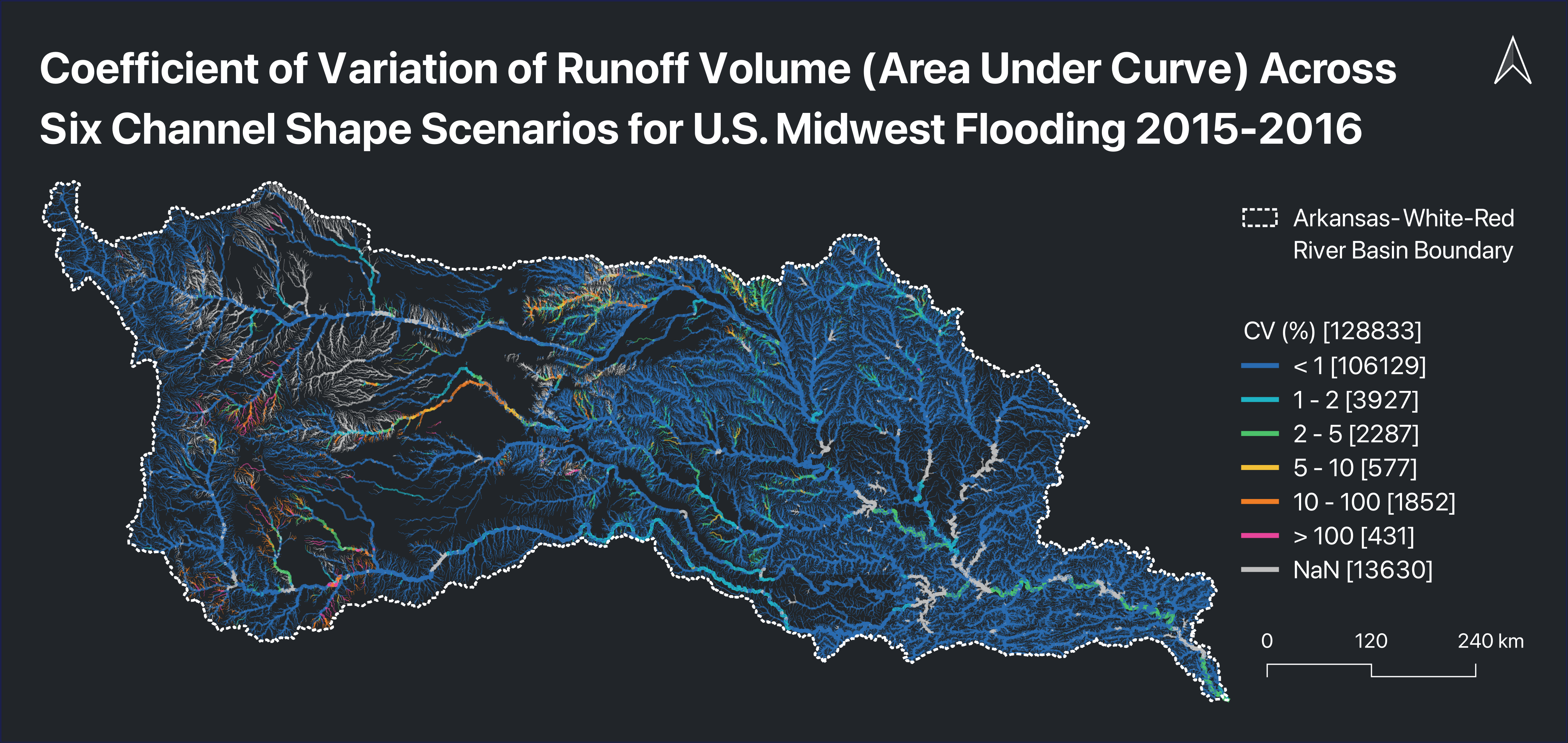
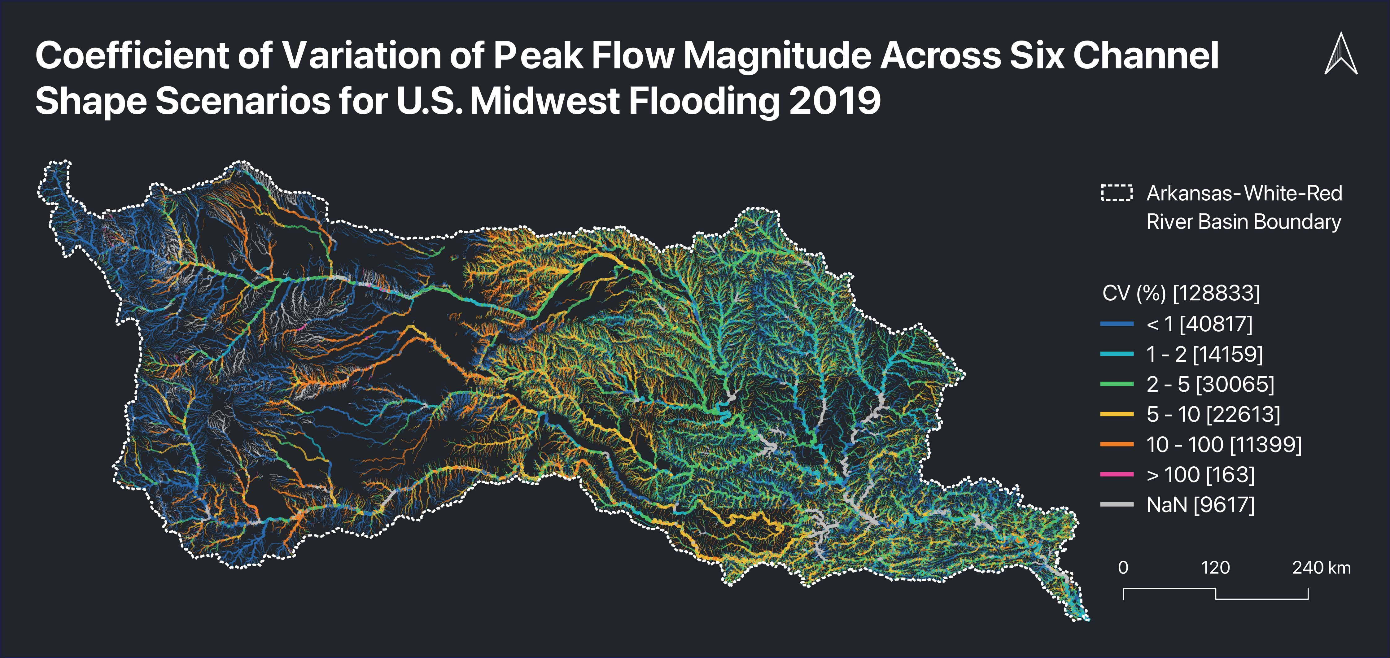
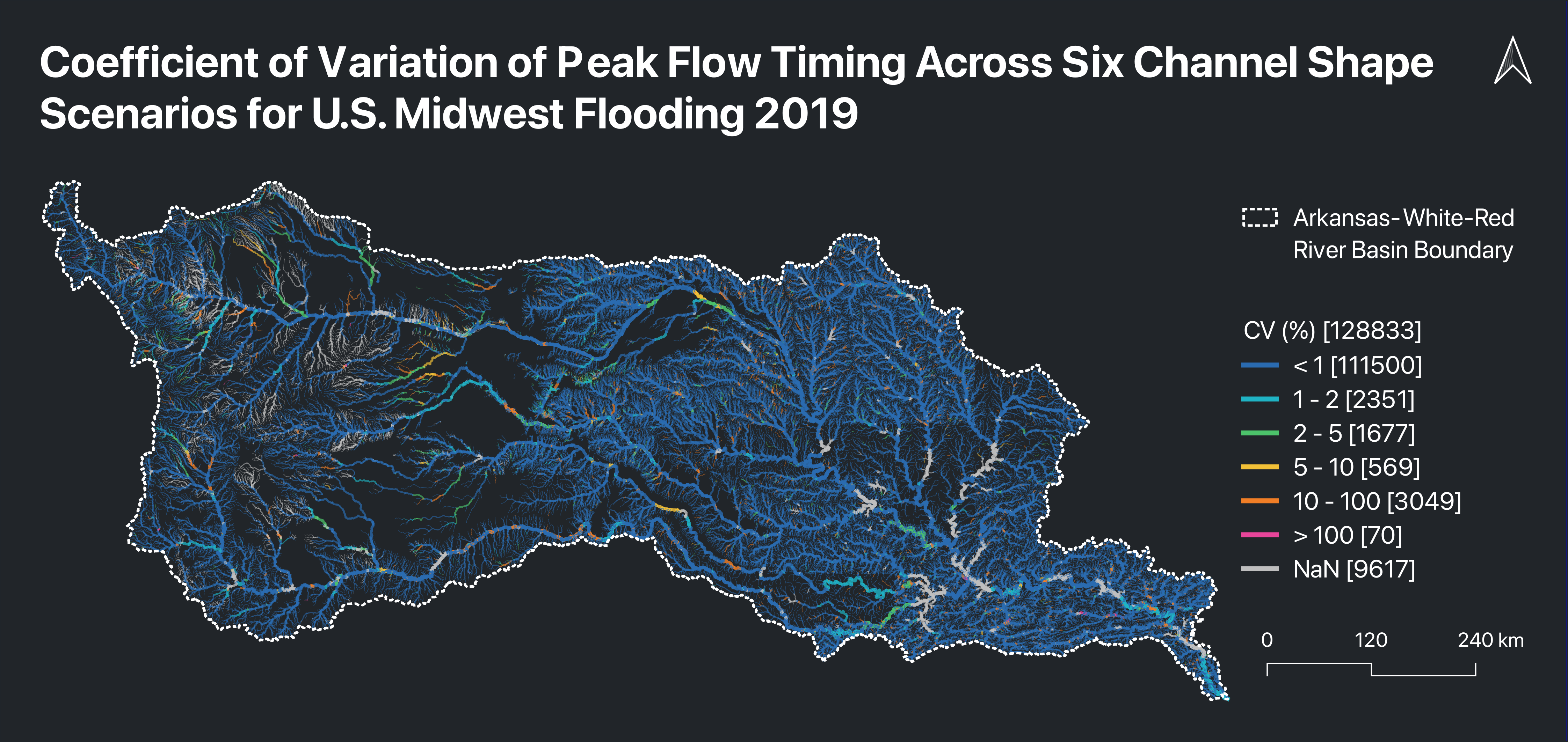
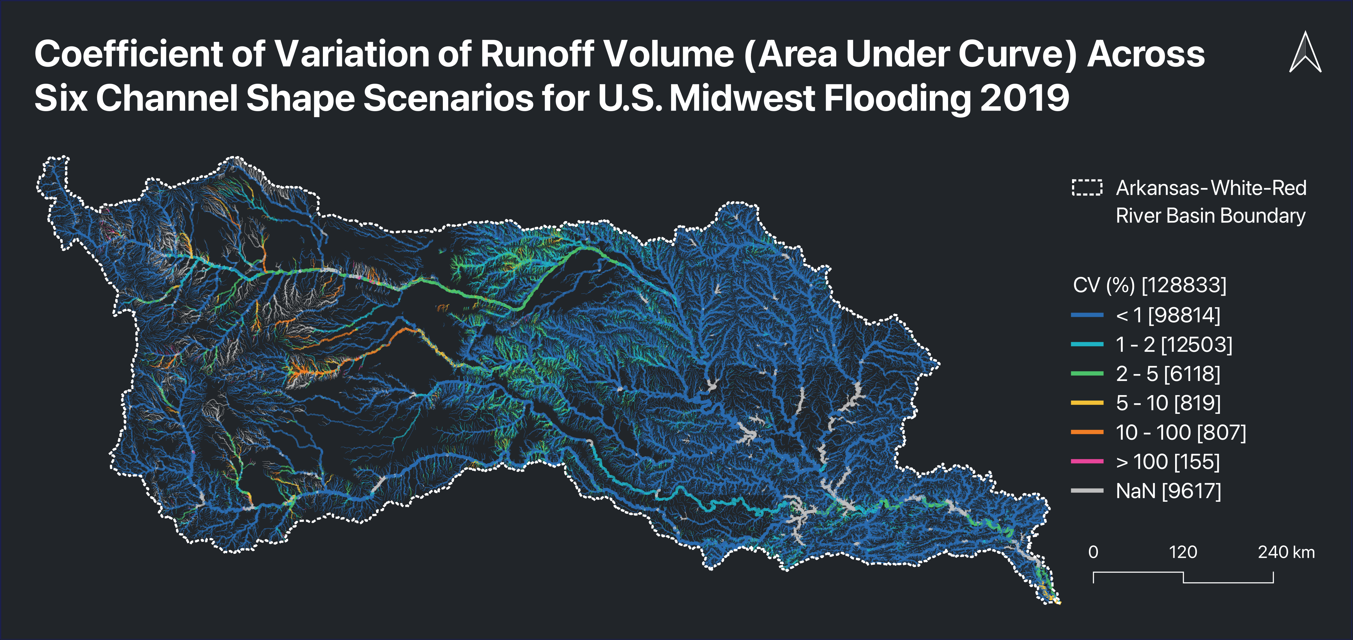
Updated NWM T-Route with CONUS-wide ML-derived channel geometry and evaluated how channel side slopes affect simulated peak flow, peak-flow timing, and runoff volume during major floods in the Arkansas-White-Red Basin. Sensitivity of peak flow and runoff volume generally increased with flood magnitude, while sensitivity of peak-flow timing decreased but became more variable.
Paper (coming soon)Updated T-Route geometry file (coming soon)
How good is your flood map? Benchmark it against 204 reference maps.
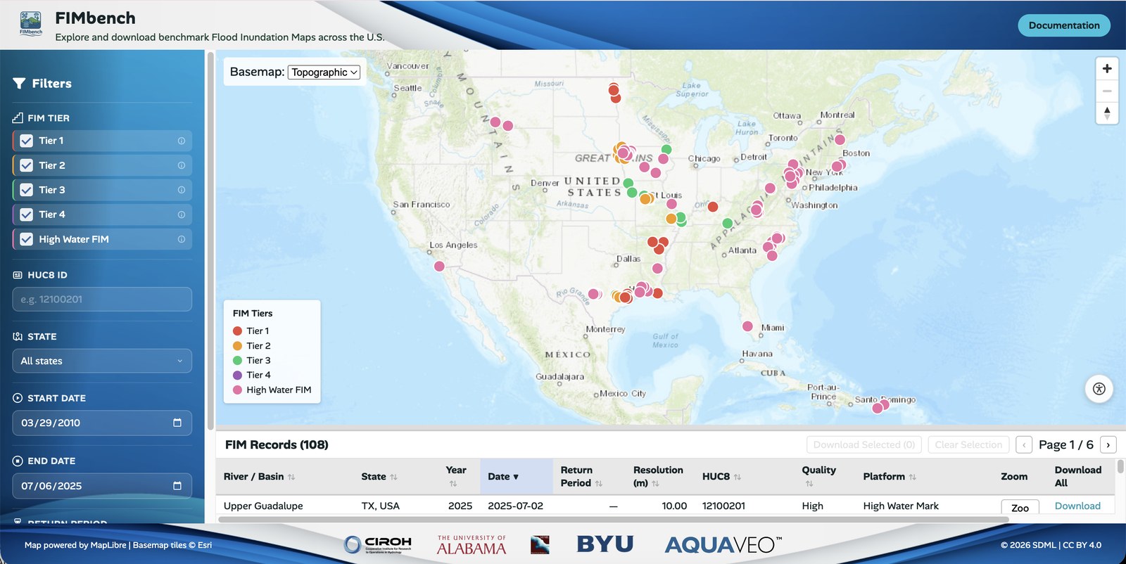
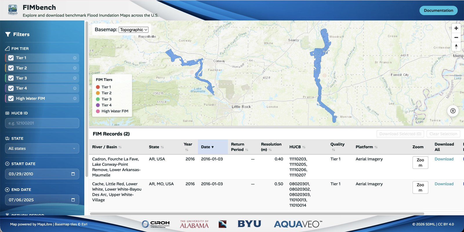
A benchmark database of 204 standardized flood inundation maps across CONUS, built from NOAA aerial imagery, PlanetScope and Sentinel-1 SAR imagery, FEMA Base Level Engineering floods, and USGS high water marks.
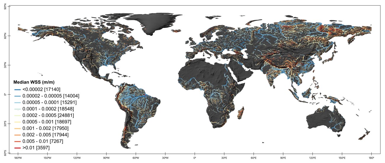
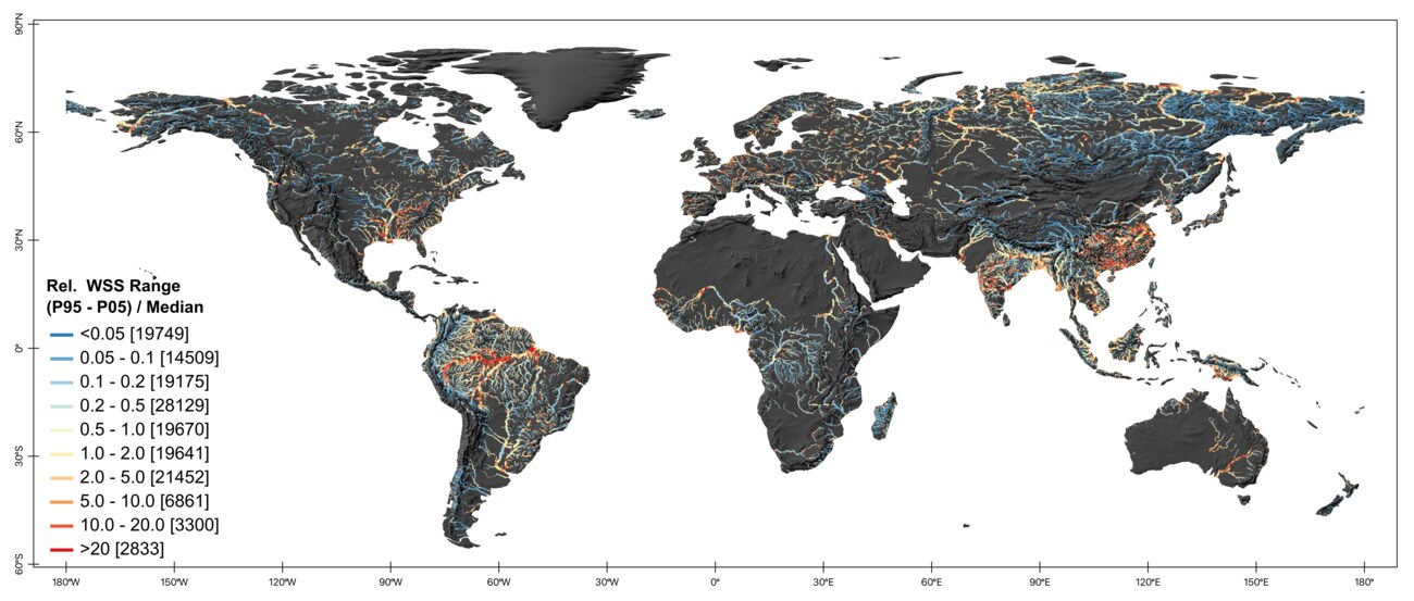
A global dataset of temporal water-surface elevation (WSE) and water-surface slope (WSS) across 155,319 river reaches, derived from three years of Surface Water and Ocean Topography (SWOT) observations. The study shows substantial, spatially organized temporal variability in river WSS, with a global median relative WSS range of 0.44.
Paper (coming soon)
Where did Hurricane Harvey cause the most building damage, and why?
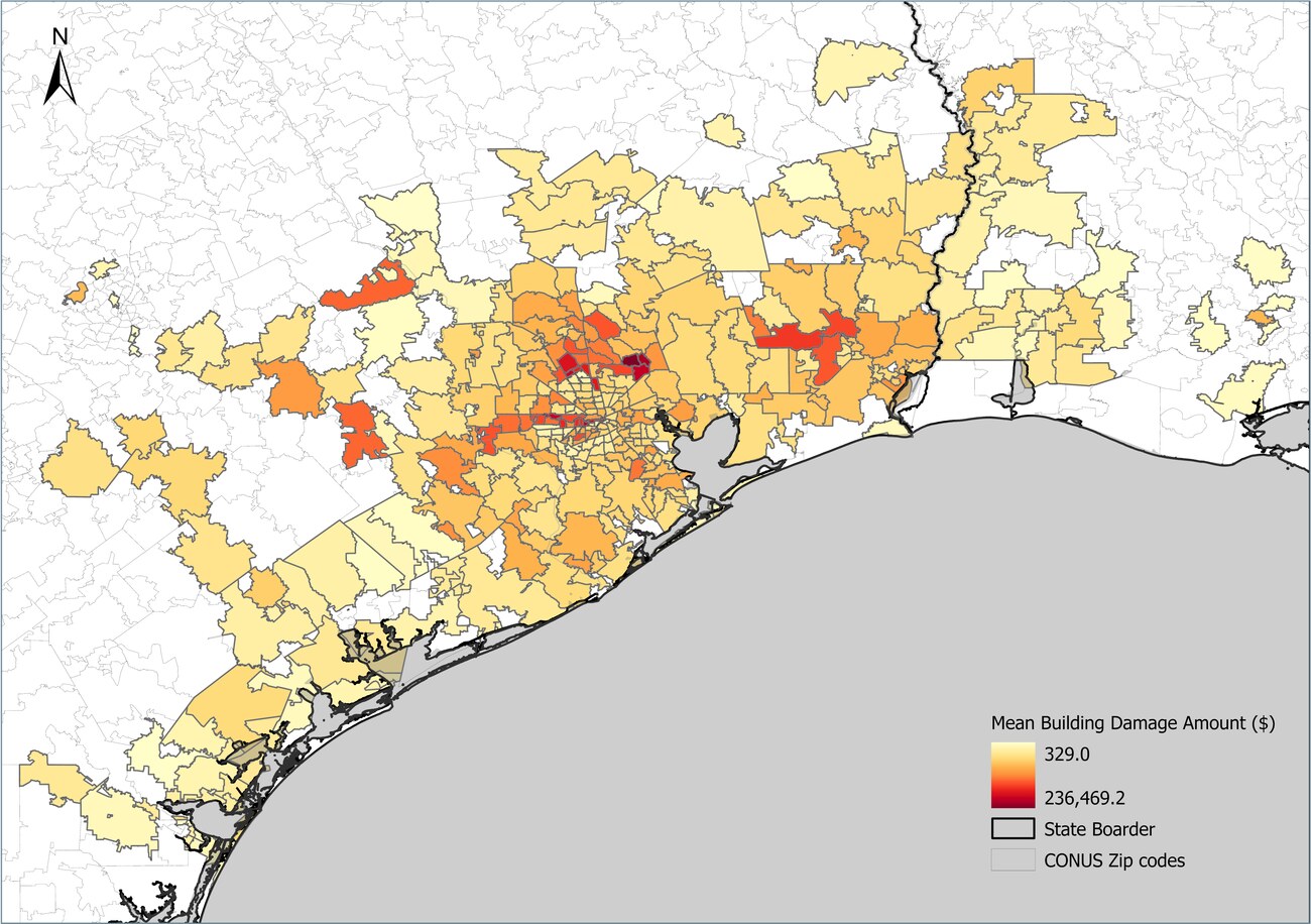
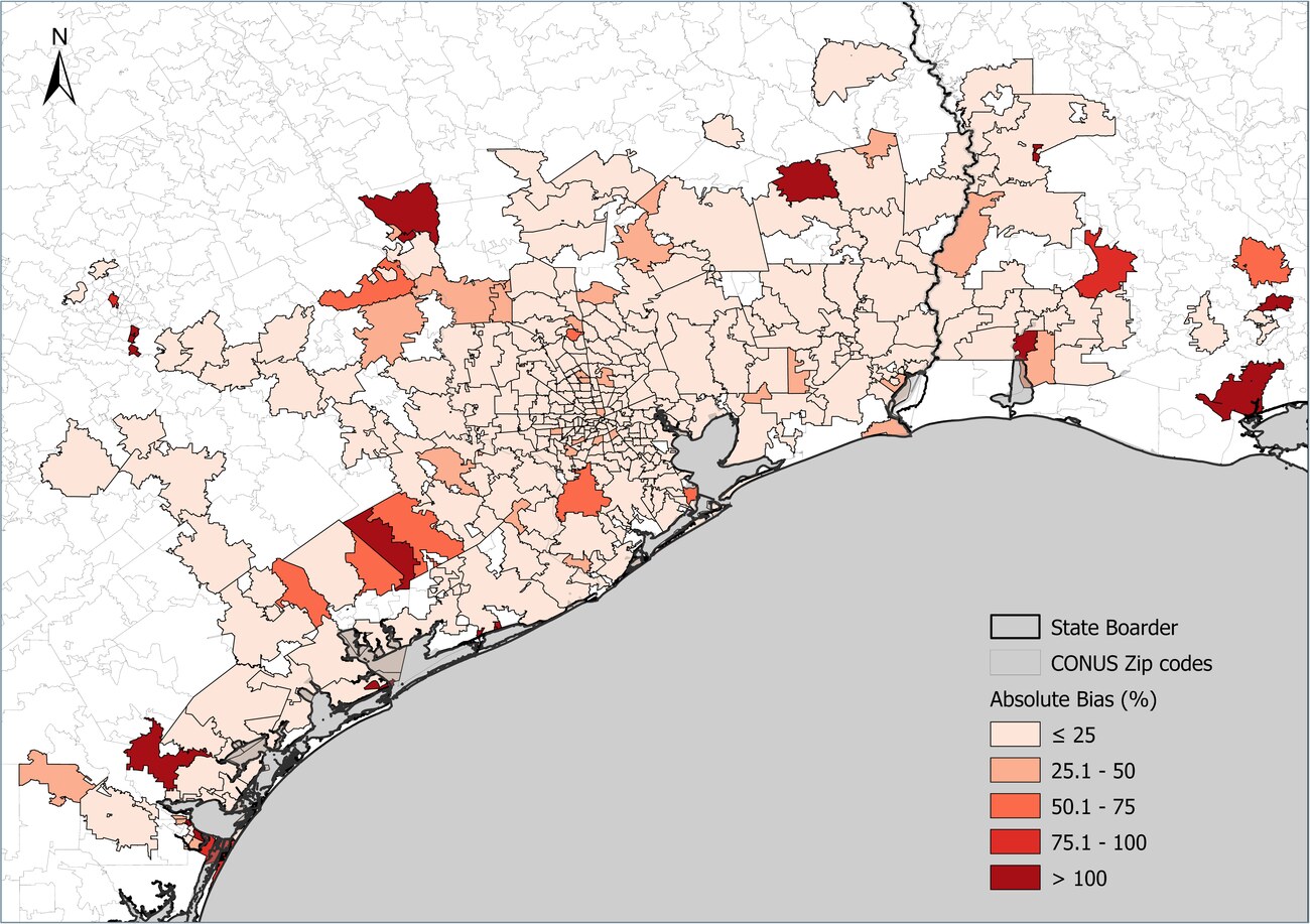
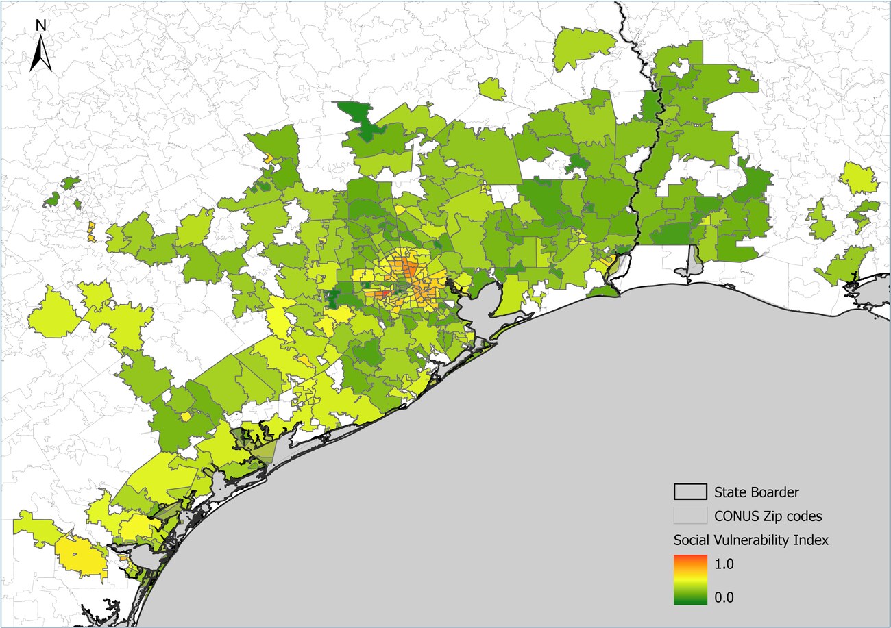
Machine learning estimates of flooded building damage across Texas and Louisiana following Hurricane Harvey (2017) at the ZIP-code scale, integrating NFIP flood-insurance claims with geospatial, hydrologic, and socioeconomic data. Feature-importance analysis showed that damage was highest where recorded flood depth and building value were greatest, particularly for two-story buildings.
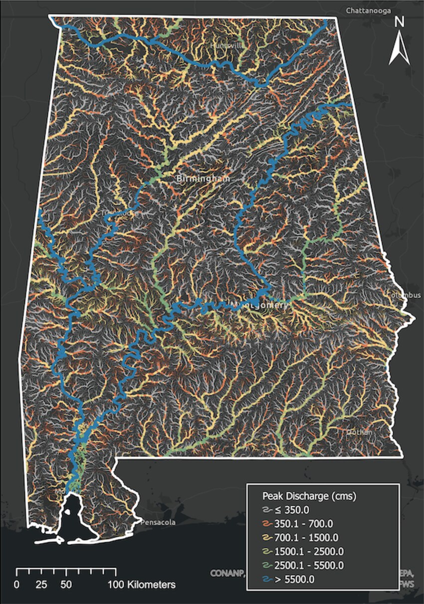
Machine learning estimates of maximum of annual peak-flow discharge for ~78,000 river reaches across Alabama, using USGS streamflow observations with channel geometry, soil, drainage-area, dam, and other geospatial datasets. Estimated peak flows range from 0.0085 m³/s in the Lower Coosa River to 12,561.29 m³/s in the Tennessee River, with a median of 247.94 m³/s.
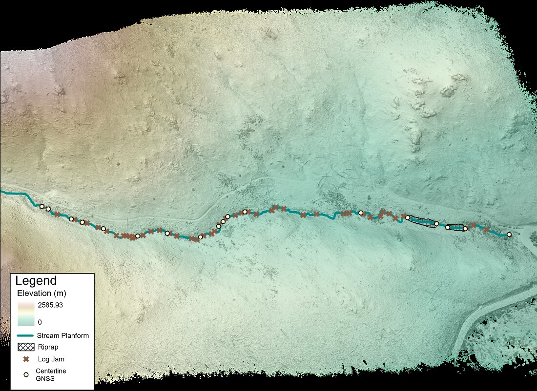
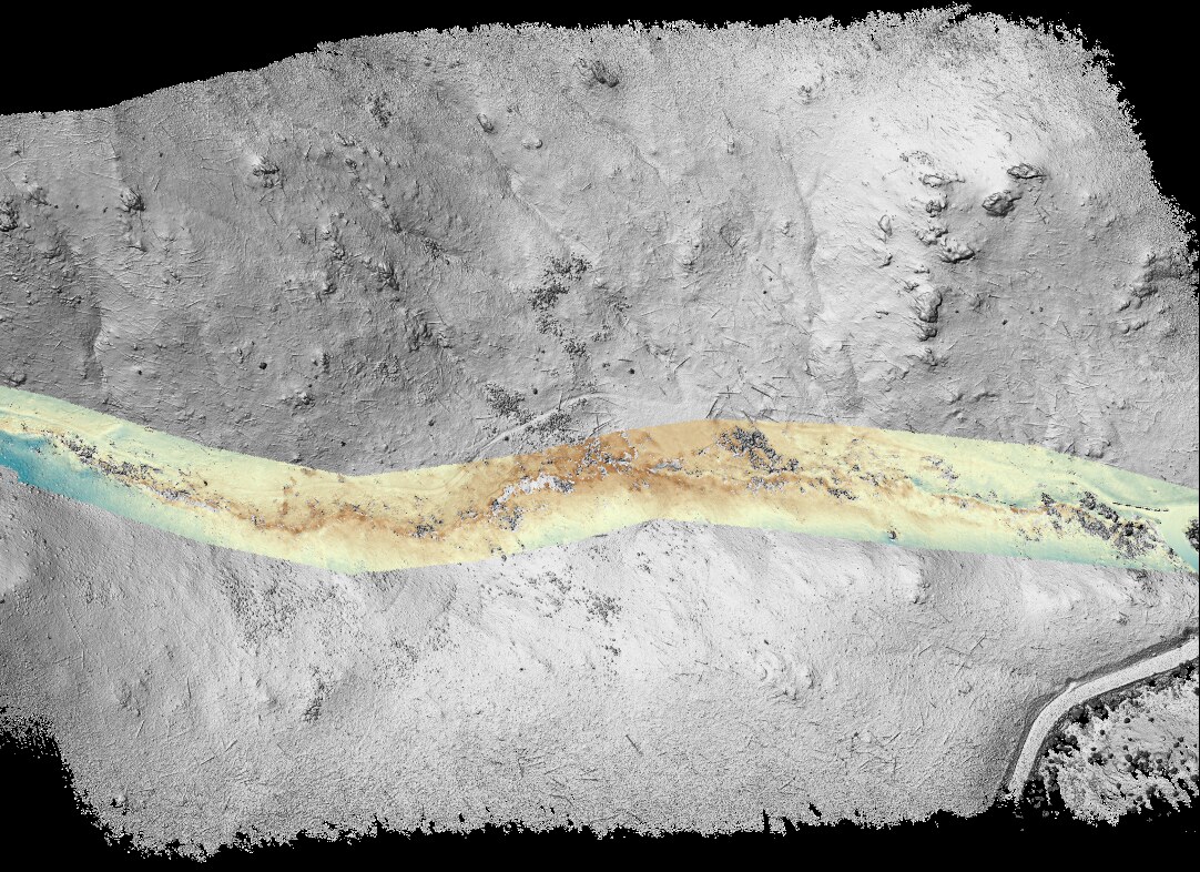
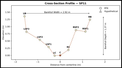
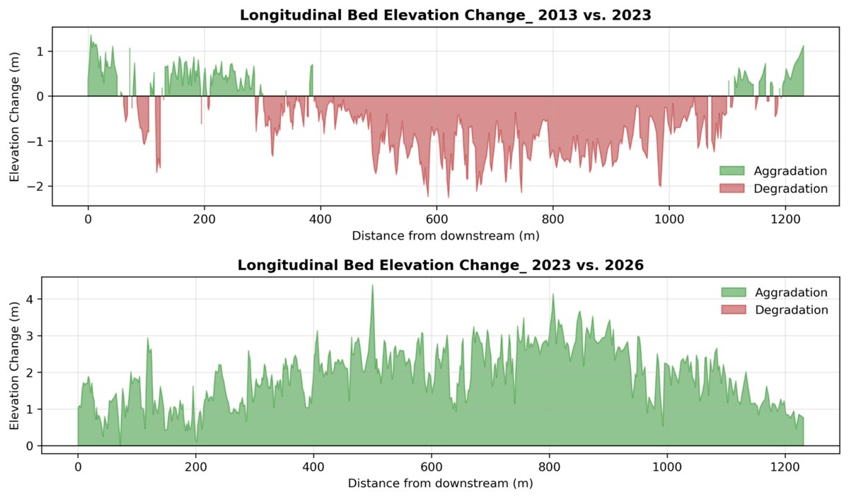
A field-based study of how a high-elevation Rocky Mountain stream (Colorado) responded to the Cameron Peak Fire in 2020 and subsequent erosion-mitigation efforts. Generated high-resolution DEMs from airborne LiDAR and UAV surveys, surveyed cross-sections using RTK-GNSS, and quantified longitudinal bed-elevation changes from 2013, 2023, and 2026. Results showed a shift from post-fire degradation to aggradation following erosion-mitigation measures.
When the flood map says “maybe”: accounting for roughness
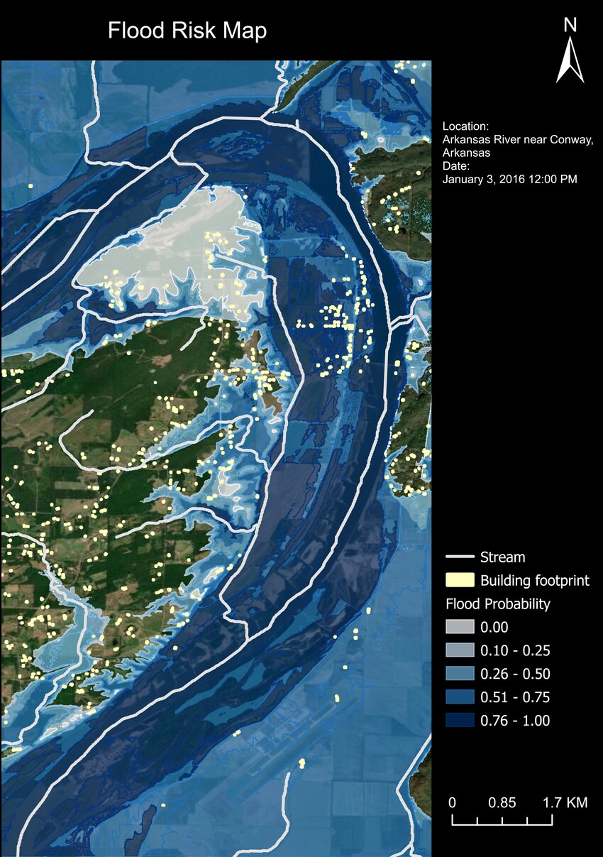
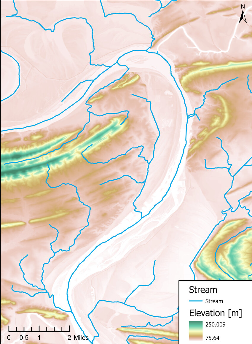
A probabilistic flood inundation mapping framework using HEC-RAS simulations and the GLUE uncertainty method to quantify flood-map uncertainty under varying land-surface roughness along the Arkansas River near Conway, Arkansas. Flood extent increased with Manning's n, while the highest-probability zones (0.76-1.00) remained concentrated along riverbanks and low-lying floodplains.
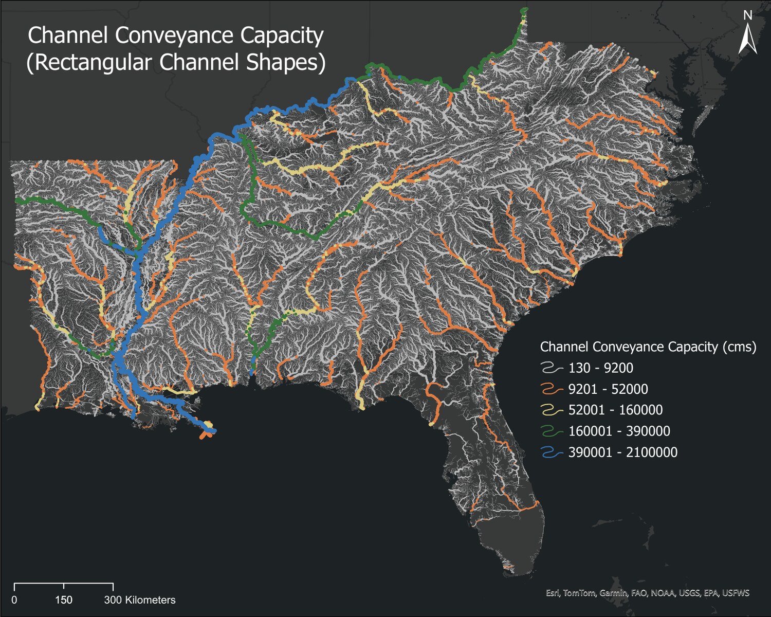
Not all rivers carry water the same way in the southeastern U.S.!
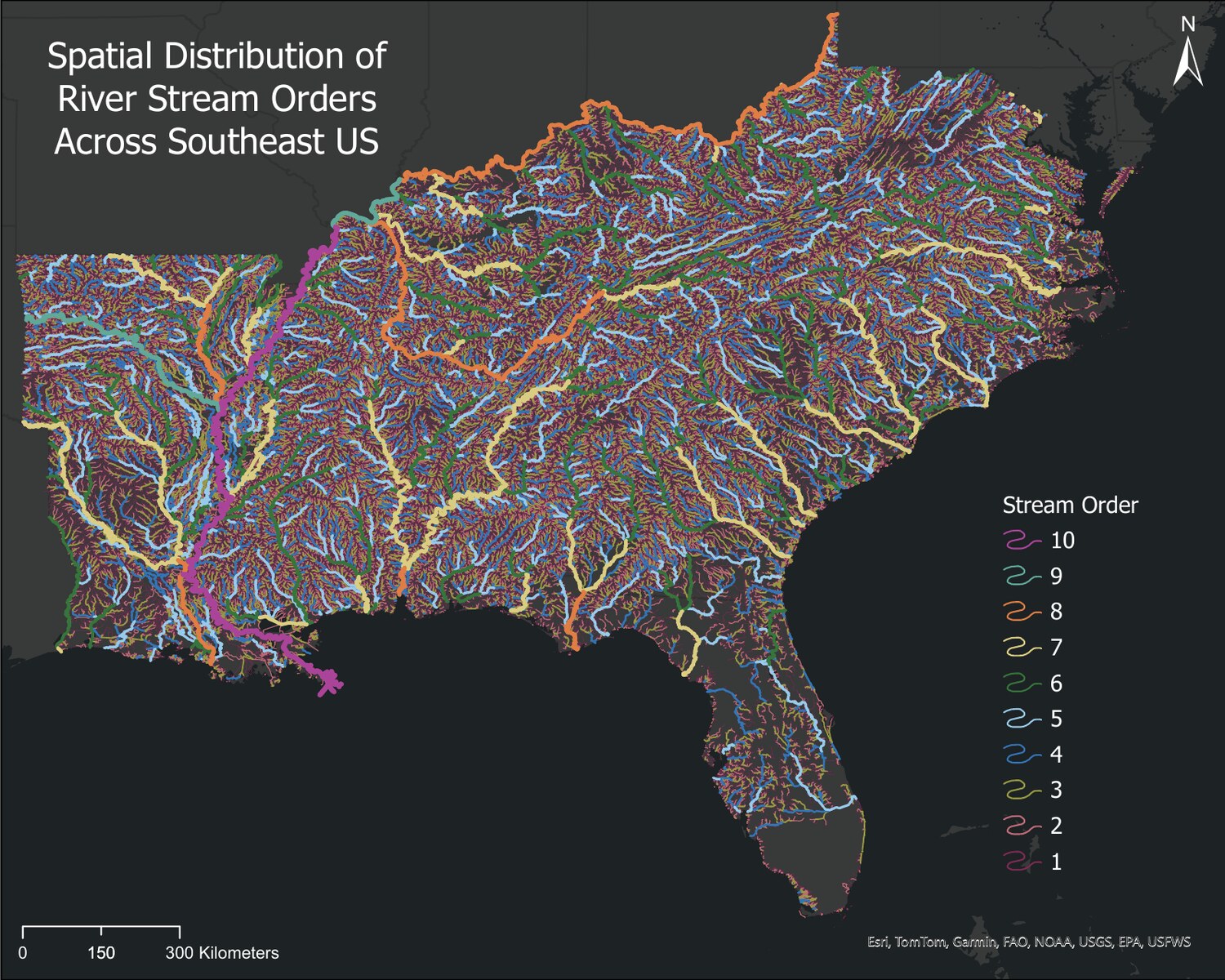
Geospatial analysis of nearly 700,000 streams across the southeastern U.S. showing that channel shape, not just channel size, is a first-order control on river conveyance. A triangular channel with 50% less cross-sectional area can convey roughly six times less water than a rectangular channel at the 2-year flood, with the effect diminishing rapidly downstream.
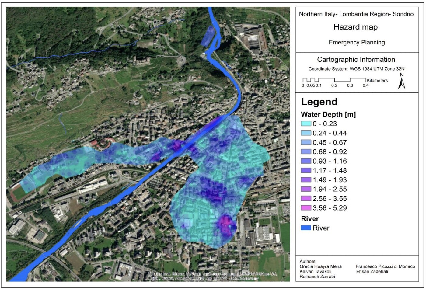
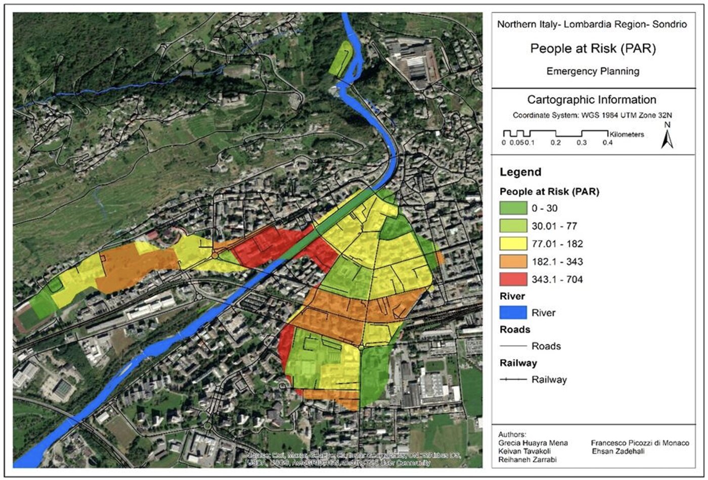
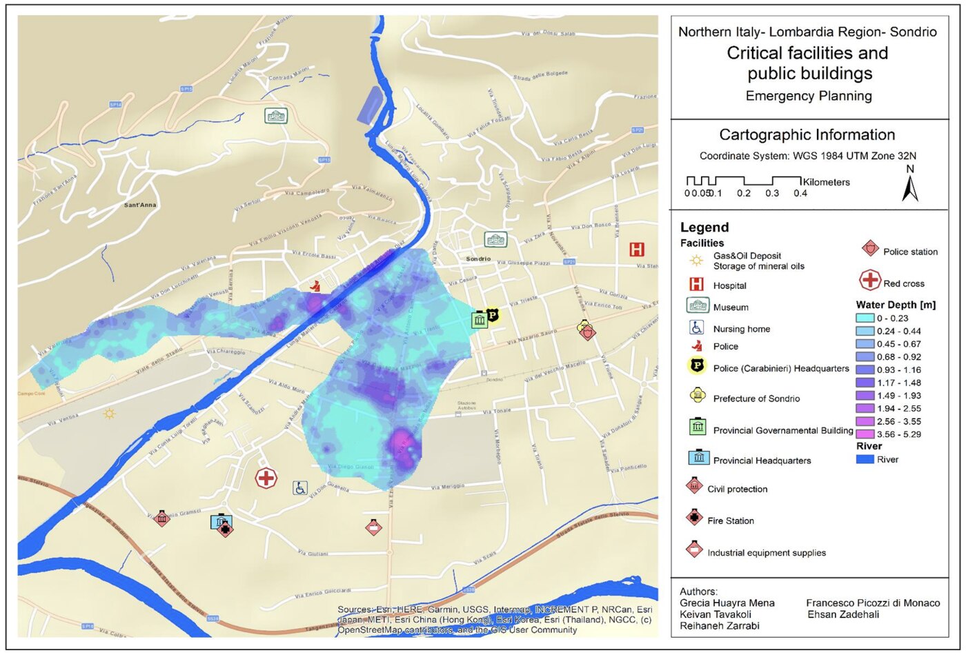
From landslide to flood: planning for the unexpected
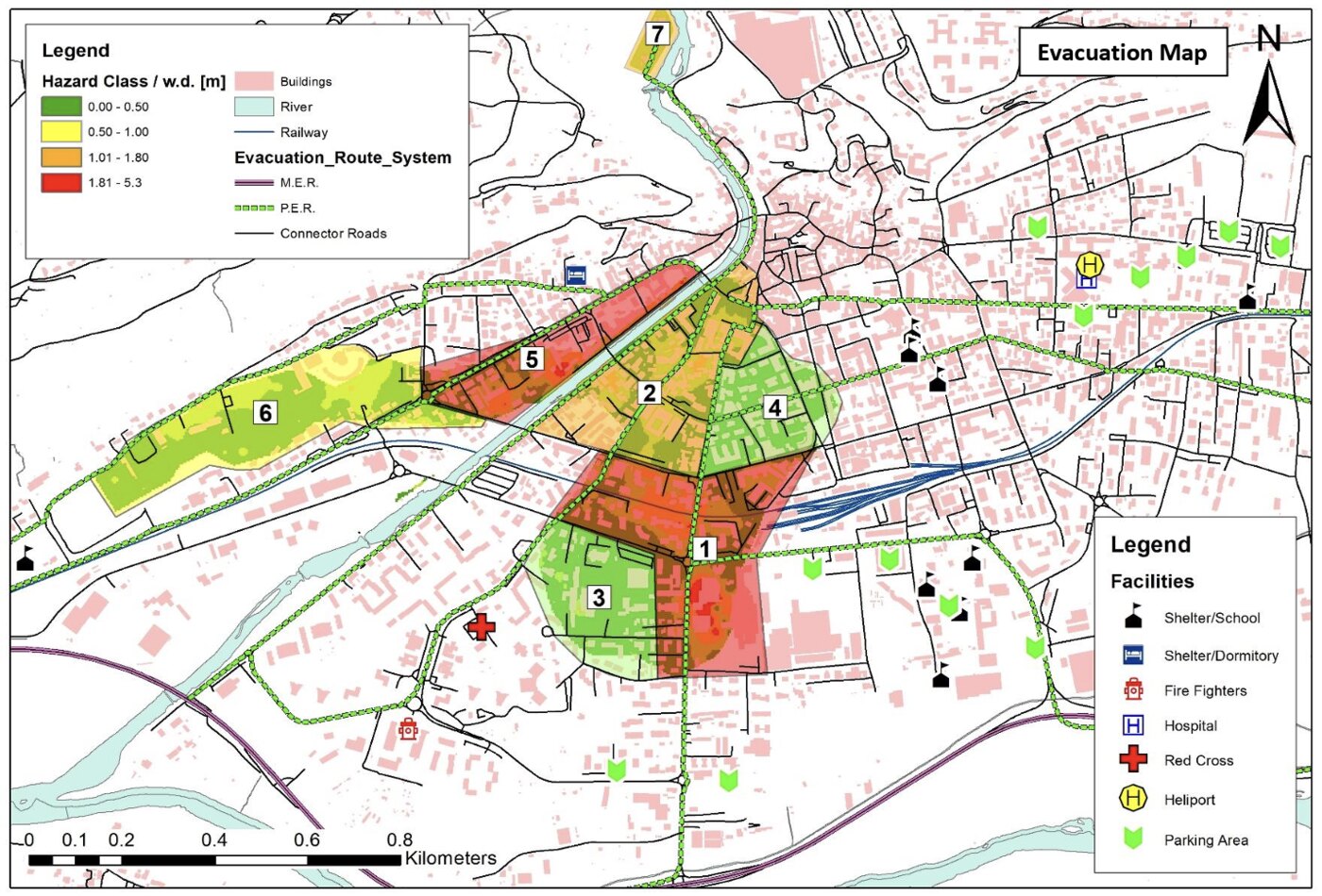
An integrated assessment of hydrogeological hazards in the mountain area of Sondrio, Italy, evaluating a potential natural dam-break scenario associated with the Spriana landslide and modeling flood-wave propagation and sediment release through River2D and BASEMENT.
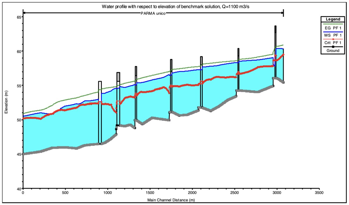
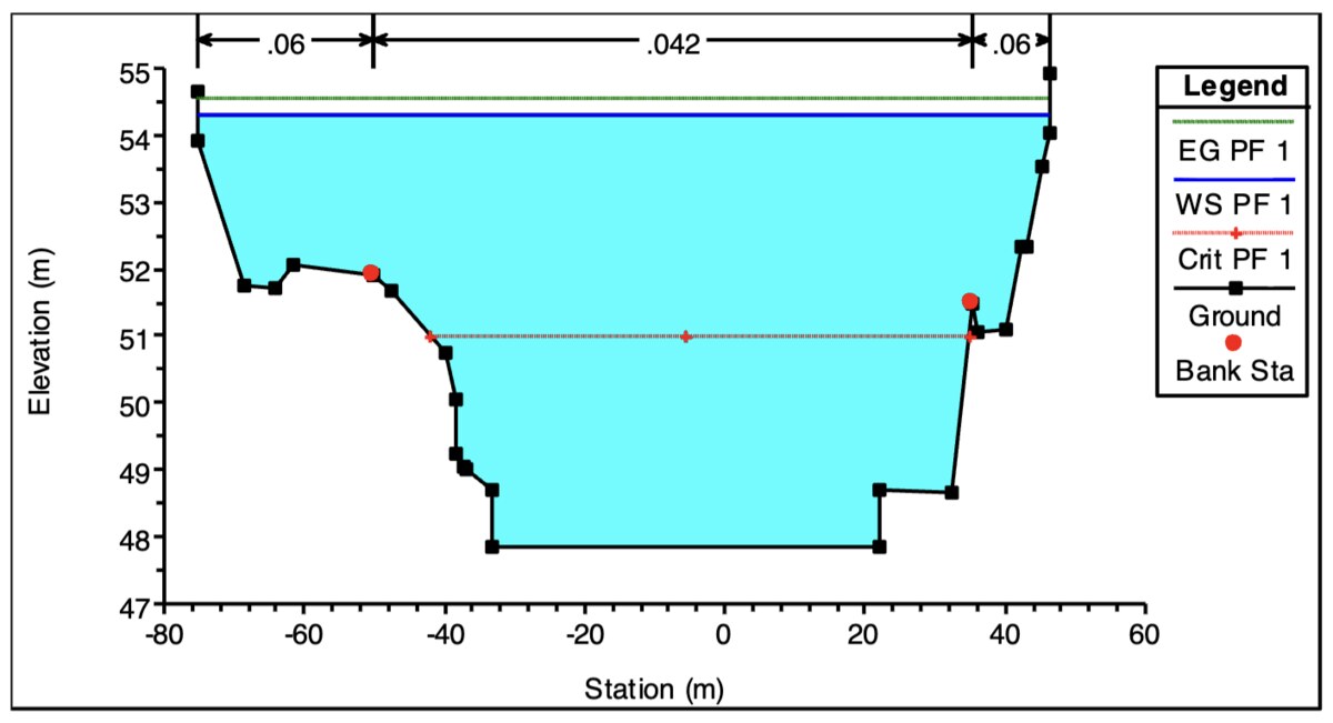
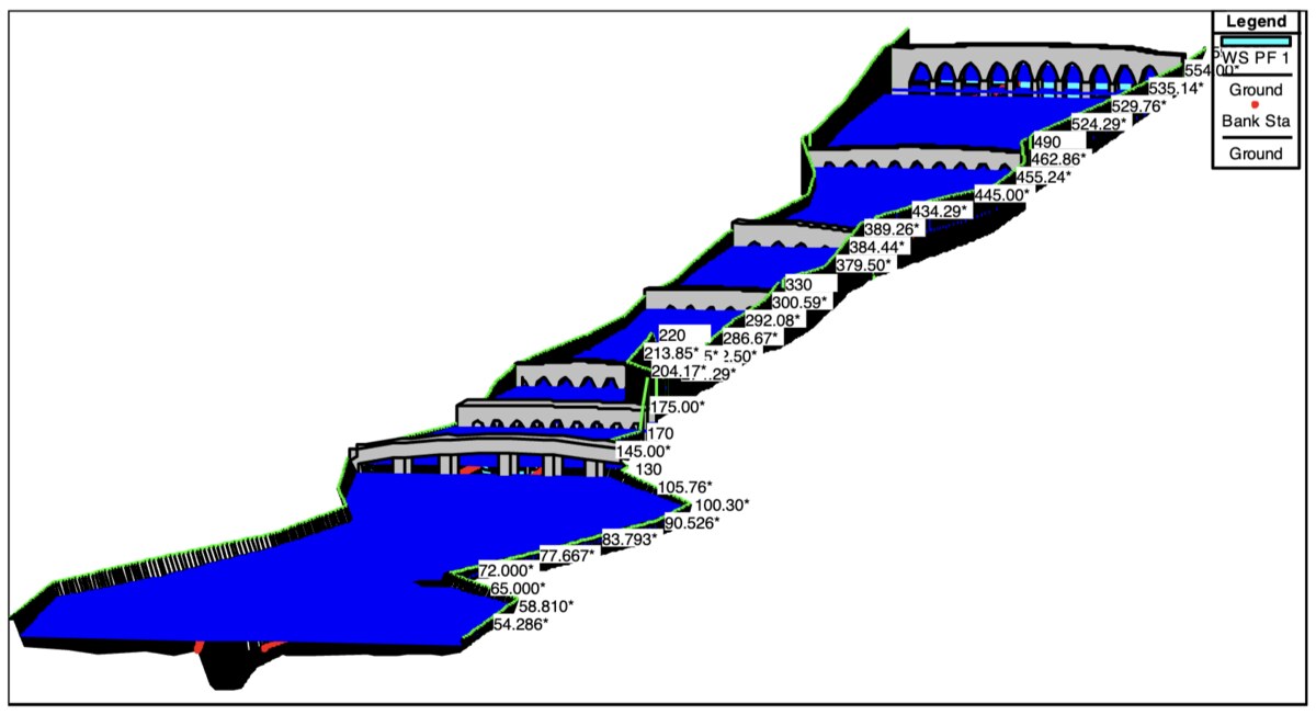
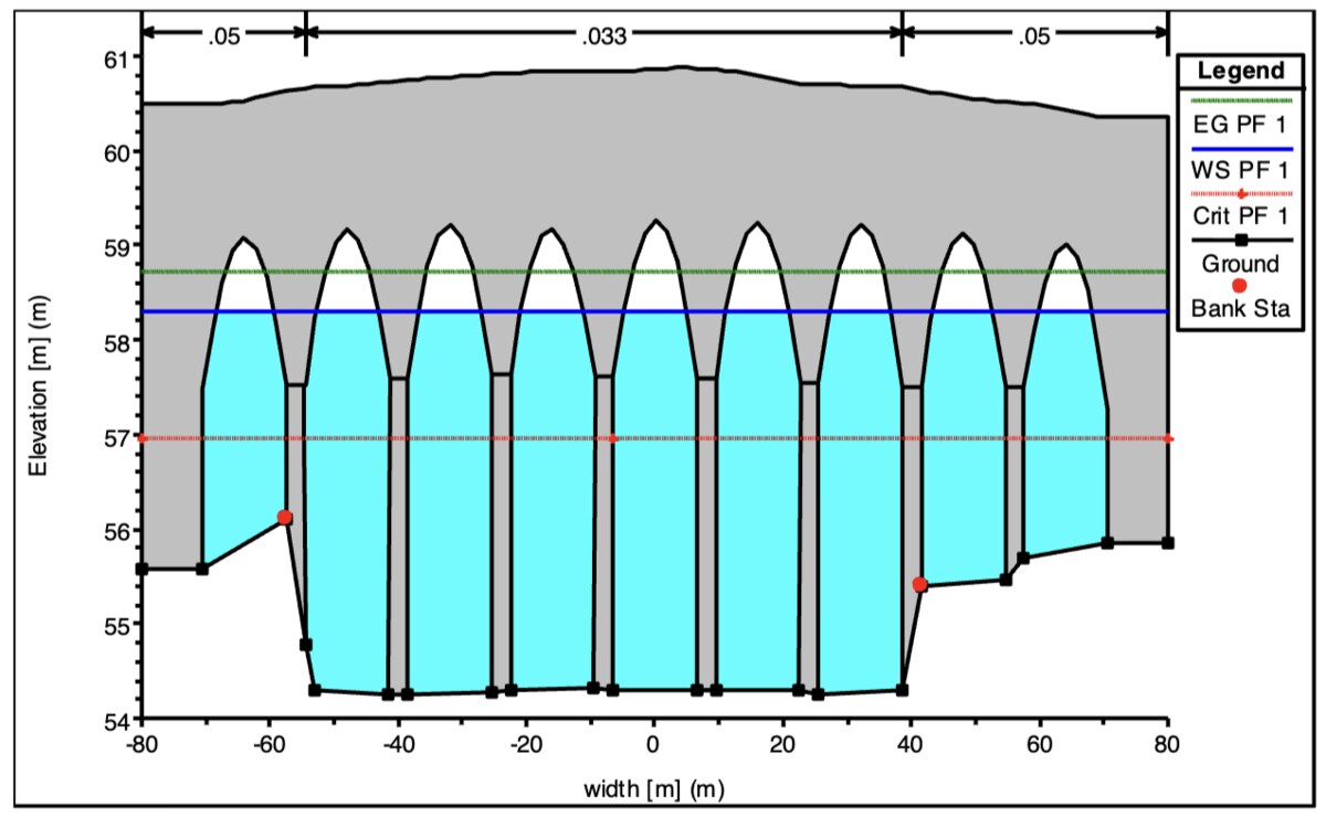
An assessment of how bridges, sills, and other engineered features control river hydraulics and flood behavior along the Parma River near Parma, Italy, using HEC-RAS hydraulic modeling. Bridges and sills acted as local hydraulic controls, with the Italia Bridge triggering a transition from subcritical to supercritical flow and a hydraulic jump.
Taught an introductory human-geography course emphasizing how people interact with their surroundings, make decisions, and shape the world at local and global scales.
Delivered an introductory physical-geography laboratory using Google Earth Engine and climate datasets to explore and visualize spatial and temporal patterns in weather, climate, and environmental data.
One-on-one tutoring on open-channel flow, energy and momentum principles, and sediment transport.
Theory of Plasticity
One-on-one tutoring on yield criteria, stress–strain relationships, and elastoplastic material behavior.
Undergraduate Teaching Assistant
Department of Civil Engineering, Sadjad University of Technology, Iran · AY 2016–2018
Fluid Mechanics I Lab (CE 400-level)42 undergraduates
Guided students in applying theoretical concepts of fluid mechanics and hydraulics to engineering problems.
Leadership & Mentoring
Research Mentor
AI for Operational Hydrology Program, University of Alabama Graduate School · Summer 2026
Mentored an undergraduate computer-science researcher on applying machine learning to environmental modeling and geospatial problems, developing LSTM models to estimate annual-maximum discharge across CONUS in support of more accurate flood-frequency analysis for river reaches nationwide.
Panelist
Graduate Teaching Assistant Workshop, University of Alabama Graduate School · Summer 2026
Research Evaluator
Undergraduate Research & Creative Activity Conference, University of Alabama · Spring 2026
Undergraduate Research Mentor
Surface Dynamics Modeling Lab, University of Alabama · 2024–2025
Mentored an undergraduate student on the post-processing and visualization of operational flood-inundation-mapping products.
Mentored an undergraduate student on a data-acquisition and quality-control pipeline for river channel hydraulic datasets used in large-scale river modeling.
Journal Reviewer
Environmental Modelling & Software · Journal of Hydrology · Water Resources Research · 2025–Present
Codes & Tools
Open tools, code, and datasets from my research on river channel geometry, flood mapping, and hydrologic modeling.
Tools
Web app, API & Python package
HydroGeom
ML-derived bankfull and mean-flow channel width and depth for ~2.7 million NHDPlusV2.1 reaches and 28,000 USGS gages.
“All models are wrong, but some are useful.”
— George Box
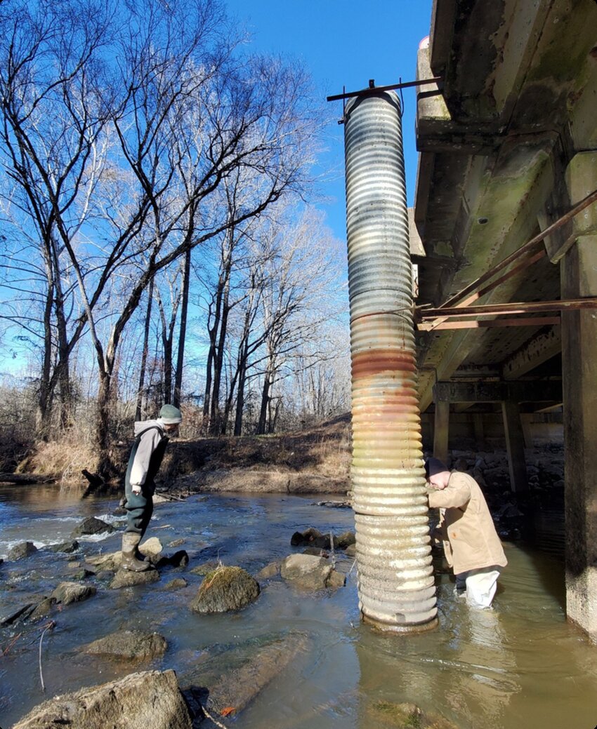
Coalfire Creek, Pickens Watershed, Alabama, USA · January 2024
This quote has stayed with me because it captures something I find fascinating about science: we try to understand a complicated world with tools that can never capture all of it.
A perfect example of such a complex system is a river system. A river can be reduced to lines, numbers, equations, and maps, but a real river is never just those things. It moves, changes, responds to its surroundings, and behaves differently from what we expect. That tension between the complexity of the real world and the simplicity of our representations is what keeps me curious.
And this curiosity has shaped the way I work. I bring together geospatial data, hydrology & hydraulics concepts, environmental modeling, and data science techniques to better understand rivers and floods. But I’m not only interested in what a model tells us. I want to understand what it leaves out, which assumptions shape the results, and what those limitations mean when we take the model into the real world.
For me, this matters because the things we model are not just numbers on a map. Floods affect homes, infrastructure, ecosystems, and communities. Better ways of understanding rivers and floods can lead to better information about risk and help people prepare for events that can have very real consequences.
That is the perspective I bring to my research, teaching, and the problems I choose to work on: not looking for a perfect representation of the world, but finding better ways to understand its complexity and making that understanding useful.
Education & Certificates
Ph.D., Geography & the Environment2023 – Dec 2026 (expected)
University of Alabama, USA
M.Sc., Civil Engineering for Risk Mitigation2019 – 2022
Politecnico di Milano, Italy
B.S., Civil Engineering2014 – 2018
Sadjad University of Technology, Iran
Geodetic Methods Certificate2026
EarthScope Consortium
Operational Hydrology Certificate2026
University of Alabama Graduate School
Honors, Awards & Recognitions
Thomas Graziano Research to Operations AwardSep 2025
Team recipient, SDML · CIROH Science Meeting 2025
Early Career Paper AwardMay 2025
3rd Annual CIROH Developers Conference
Outstanding Teaching AwardApr 2026
Department of Geography & the Environment, University of Alabama